MBRC Planning Scheme - Joyner South emerging community area
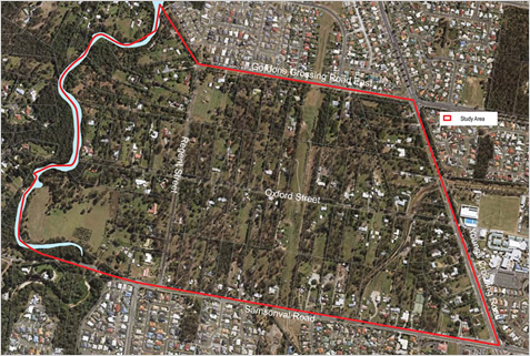
The Joyner South area is bounded by Samsonvale Road in the south, Youngs Crossing Road in the east, One Mile Creek in the west and Gordons Crossing Road East in the north. As part of its planning scheme preparation, Council has conducted a preliminary investigation to assess the future development potential of Joyner South.
The early investigation confirmed the area has potential to accommodate new residential growth, likely in the form of a next generation neighbourhood located close to existing shops and services.
However, before the Joyner South area can be zoned for residential development, further detailed research and analysis is now required. This includes assessment of the provision of infrastructure that would be required to cater for growth in this area. Further studies are expected to be undertaken over the coming years.
Joyner South emerging community area
Joyner South and the planning scheme
The zone for the area shows what could happen over the next 10 years (the life of the planning scheme). Land within the Joyner South area is included within the Emerging community zone - Transition precinct. This precinct ensures new development does not compromise future land use and development in the area.
The area does not have adequate development infrastructure or the ability to be serviced at this point in time. Council needs to undertake further investigation into the feasibility of providing suitable infrastructure to facilitate development.
Development in this area is to maintain a semi-rural character until such time as infrastructure is delivered and relevant site specific constraints are resolved. It is envisaged that a concept plan for the whole area and infrastructure agreement will be required to bring forward major development. The planning scheme will guide future development of this area in accordance with the Next generation neighbourhood place type vision.
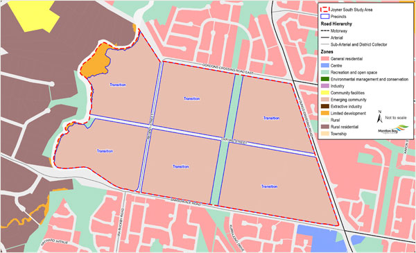
Zone map - view full size map(PDF, 439KB)
Strategic vision for Joyner South
Council’s 20-year vision for Joyner South, identified in the Strategic Framework, is for a Next Generation Neighbourhood. A range of studies need to be conducted before the area can be developed. It is envisaged the area will continue to evolve in line with the long-term outcomes sought in the Strategic Framework.
More information on the Next Generation Neighbourhood place type is available in the strategic framework, section 3.14 MBRC Place Model (section 3.14.9) and the Emerging community zone code – Transition precinct (section 6.2.3.2).
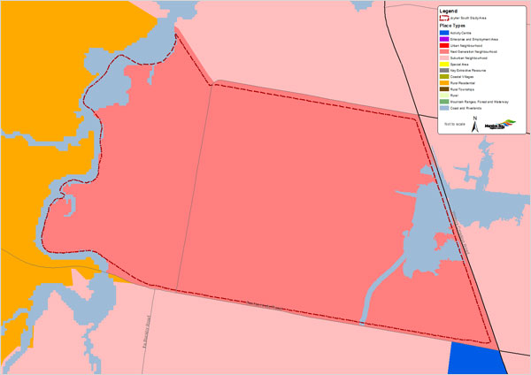
Strategic Framework place type map
To find out the categories of development and assessment (type of application required, if any) in the Joyner South area, refer to Part 5 Tables of assessment of the planning scheme. Assessment benchmarks (requirements) for development (material change of use) in the area can be found in Part 6 Zone codes, 6.2.3.2 Emerging community zone, Transition precinct. Assessment benchmarks for reconfiguring a lot in the Emerging community zone can be found in Part 9 Reconfiguring a lot code, section 9.4.1.3 Emerging community zone, Transition precinct. Refer to the Emerging community zone information sheet for more details.
Joyner South is an expansion area that is to be considered in the Regional Growth Management Strategy 2041 currently being prepared. The strategy will develop evidence-based options that will ultimately outline the preferred sequencing strategy for the City’s future expansion areas.
Note: it is recognised that during preparation of the strategy landholders still have the right to submit development applications. Such applications will be assessed against the planning scheme in effect at the time.